ELP Protocol 2015/2016 Planting Monitoring:
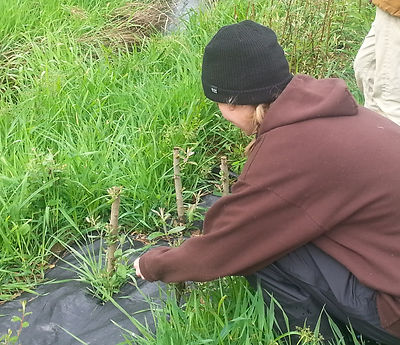
A main focus on this project is to monitor previous year's plantings for survival, growth, and vigor. To complete this, our team used the 2015 ELP Riparian Restoration Plant Monitoring Protocols which utilize four circular plots - two plots on each bank of the stream all representative of planting diversity. Within plots, each plant has a unique tag number to help track changes year to year. Each monitoring session, every plant is measured for growth, assessed for damage from wildlife and competition by invasive species. This information is then used to understand which species are best suited for different
locations, surviving animal grazing, and project success overall.

Pollinator Survey:
For finding what is helping flowers develop into blueberries on Whitewater Ranch, we used the UO ELP Blueberry Pollination Native Pollinator Protocol — originally modified from Katherina Ullmann's Citizen Scientist Pollinator Monitoring Guide. Using these guidelines our team conducted two Spring time surveys to evaluate the frequency and identity of bees and flies visiting reproductive parts of blueberry flowers. Conducted on 60 meter long transects, students observed crop rows over a 20 minute period (walking about 3 meters per minute). As we observed insects in the same transects as previous ELP teams, data collected from these surveys is valuable in comparing the presence of pollinators year-to-year. Additionally, this method allows us to discerne how effective our planted pollinator hedgerow is at attracting native bees to the flowering plants surrounding Goose Creek.

Our Project's Methods
Aquatic Macroinvertebrate Survey:
We conducted two surveys at three locations along Goose Creek to evaluate it's general health through the presence or absence of different animals living in the water. With team members wading into the Creek at the same locations previous teams analyzed, we used nets to collect invertebrate specimens. After collecting organims, we identified animals using dichotomous keys and separating them by the following major groups - shredders, scrapers, gathering collectors, filtering collectors, and predators. After this organization, we recorded the number of distinct taxa occurring within each category. Following this, our team determined the general health of Goose Creek based upon all the different aquatic organisms thriving below the surface.
Stream Temperature Monitoring:
Like previous year’s ELP teams, we used thermometers and set GPS points to measure water temperature at the beginning and end of our Spring term. Temperature was collected between 12:00 and 2:00 p.m. in order to keep data consistent with previous groups while reducing temperature variability throughout the day. As our overall project goal is to have our riparian forest shade Goose Creek and cool water to be healthy for native fish and other organisms, this method informs us of any effect or progress our plantings have on the aquatic environment over time.

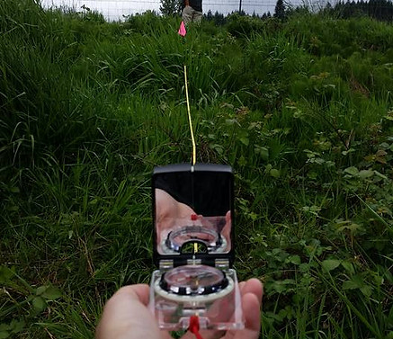
The Freshwater Trust Baseline Monitoring:
An exciting prospect for this year’s team was to extend ELP's pilot project and begin prepping large-scale restoration along the western portion of Goose Creek. The first step in these upcoming improvements was to conduct
vegetative monitoring outside of the existing planting area in order to help track changes once restoration begins. To do this, we utilized the Freshwater Trust’s baseline monitoring protocol which required us to set up twelve transects - six meter long, straight lines - intersecting the Creek. At each transect, we collected information on native, non-native (but not aggressive), and problematic invasive plants in order to gather a sense of conditions along the degraded portions of this tributary.
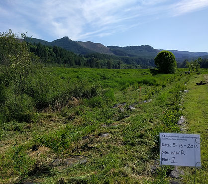
Photopoint Monitoring:
Photopoints not only allow us to visually observe our planting project's growth, but also helps us illustrate this progress to
community partners, funders, and members of the public. We continued the photopoint monitoring from 2013, 2014, and 2015
ELP Riparian Restoration teams, while establishing additional points along the unrestored portions of Goose Creek in preperation for monitoring future improvements. At each of these established points, we recreated previous photographs while including a clearly-visible reference card that contained dates, site names, and plot numbers.